Well, it was a fairly normal summer up until the middle of last month. We’d come home and helped the eldest daughter plant the summer garden, and put in a new floor in their garage, (it’s both the workout gym and her husbands Man Cave). Not to mention lots of Grandma and Grandpa time!
Then it was off to the island to help our youngest and her family settle into their new home. I spent the month painting, replacing electrical outlets and switches, trimming trees and planting a raised bed garden, while Richard was putting in a new hot water tank, faucets, toilets, cutting down cedar hedges run amok, ripping out plants gone wild, building an indoor chin up bar for their garage gym and a chin up/rings bar outside so they could keep up with their Crossfit training and of course, more Grandma/Grandpa time!
Oh, and he installed a solar system on Rosie, so our van now has all the power we could ever need! Having a son-in-law who works for one of the foremost solar companies in the world was handy. He works for Carmanah Technologies and they’ve finally decided to build portable systems for the general public, perfect for vans and small RV’s, simple to install and use. The system is call GO POWER and if you’re interested, check it out here: gpelectric.com
We also visited with Richards Dad, sister and brother-in-law as well as my sister and niece. It was busy but lots of fun, and then it was back to Penticton. Once back we stuffed our faces with cherries and Richard built a new fence and Alena and I stained it. Work, work, work, work, work, work, work!
Then about half way through July, our youngest Liz, called us to ask when we were coming back to visit as her son Cohen had asked one night before bed. Well, we really didn’t have anything pressing for the next 3 weeks so we decided to head for the island again, but this time we took a longer and slower route, not much longer and not much slower but very pretty and we hadn’t been that way in a quite a few years.
We headed north towards Kelowna, then took Highway 97C to Merrit, also known as The Connector as it meets up with the Coquihalla Highway just east of Merrit proper. We, however, were not going that way. The Coquihalla is a high speed route, over the mountains, very steep and really nasty in the winter, but it cuts 30 minutes off the trip and it’s the shortest land route from Vancouver to Edmonton. Not really our cup of tea! There are some spectacular sights along the way, but there really isn’t anywhere to stop to admire them and the high speed limits preclude tootling along. So we continued through Merrit along Highway 8 which runs through the Nicola Valley, a very pretty, slower route.
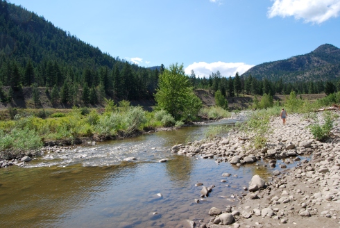
We saw a couple of Rocky Mountain Big Horn ewes, pretty close up and personal as they didn’t seem to be to concerned about our presence and we camped the night at a Forestry Campsite along the river. These types of sites are everywhere in BC, run and maintained by the Forest Service and can consist of simply places to rough camp with outhouses, all the way up to campsites with picnic tables, garbage collection and fee collection. The rates run from nothing to $10.00 per night.
If this is the way you like to camp get yourself a book called Backroads Map Books. I think there are 6 for all the different areas of BC depending on where you want to go and they will show you all the back road, logging road and off road routes, Forestry as well as Provincial campsites and fishing areas. If you spend a lot of time wandering around BC or you might in the future, these books are a necessity!
After leaving our lovely campsite we headed further west until we met up with Highway 1, at Spences Bridge and turned south onto Highway 1, the Fraser Canyon. This was just after all the big floods in southeastern BC and western Alberta so the water was definitely high!
It was kind of a sad trip down the canyon though, we were there in the middle of July and there appeared to be not a tourist in sight. Everywhere we looked, businesses were closed, private Campsites, Motels, Restaurants, even gas stations, certainly nothing like I was used to seeing! Up until that point every time we’d driven the canyon the traffic was so thick nobody managed to even come close to the speed limit, with vehicles pulled off everywhere to stop and take pictures. The place was alive with White water rafters, tourists of every descriptions and Hells Gate usually had so many people waiting to take the tram and view the rapids that you had to be extremely careful driving past so you didn’t run anybody over! This year there was no one to be seen and traffic was so light as to be almost non-existant!
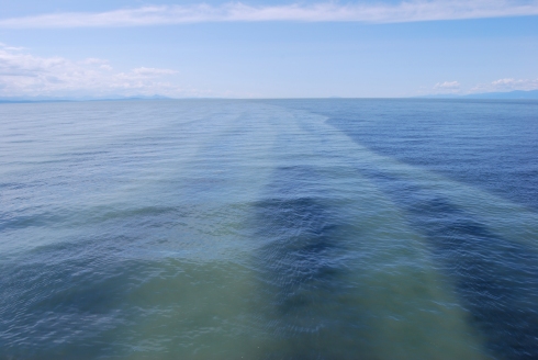
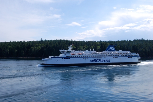
This is sediment heavy water from the Fraser River mixing with the sea waters of Georgia Straights after all the flooding in Alberta and southwestern BC.
We made it over to the island, sat and talked with the kids and grandkids, then after dinner, we headed to the local park to take the kids for a bit of play time and the dogs for a walk. My kids have taken up Crossfitting and so have I, just not to the extent they have. While we were fooling around on the play ground equipment, I grabbed a chest height bar and and leapt up planning on landing on my stomach, but I miscalculated and missed by about an half an inch. I smacked the bar right between my two lowest ribs on the right side. Ouch!!
Great, we’d been on the island for 2 hours!
We headed back, with me feeling foolish and not really sure of how badly I’d hurt myself. The next morning, with me moving cautiously, I made breakfast for us. Richard took one bite and then exclaimed, “Oh, oh”. He’d broken a tooth! ALL of Richards teeth are capped and this one had broken under the cap and below the gum line!
Great, we’d only been on the island now for barely 12 hours!
We spent the next 3 weeks with Richard going back and forth to the dental surgeon for x-rays, exams, more x-rays, cleaning, then finally extracting the tooth, not to mention the two of us hanging with the kids, and me wincing, playing with the grandkids and me wincing, dog and house sitting, oh, and painting one more wall. and me wincing! He was supposed to have an implant but due to insufficient bone mass, and a really difficult extraction, that’s not going to happen until next year.
Why is nothing ever easy?

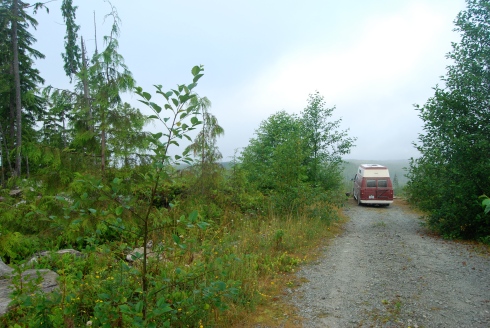
Our first night on the way to Carmanah. It’s amazing the places you can find to camp just off the road on Vancouver Island! Notice the Carmanah “GO POWER” solar set up!
While we were waiting for the final appointment, we decided to hit the road for a couple of days, just to relax, turn the phones off, and be alone. So we decided on a circle route that not many people know about, from Victoria to Duncan, via Port Renfrew with a stop in the Carmanah Valley Provincial Park, then back to Victoria, via Highway 19.
We headed for Langford then hit Highway 14 which took us out to Port Renfrew. This is a gorgeous drive that parallels the Juan de Fuca Trail. Just before you drive into Port Renfrew proper, you’ll see a road and a sign on the left hand side that says “Lake Cowichan”. This is the part of the route that few actually know about. It meanders towards the south side of Lake Cowichan and Honeymoon Bay. When we reached the intersection of Honeymoon Bay and Nitinat Lake we turned right towards Nitinat.
If we’d been following the signs for Carmanah Valley Provincial Park we never would have found it as the signage got smaller and less noticeable as we got closer. Not to mention, once we hit the intersection we needed to take just before the village of Nitinat, the road conditions deteriorated drastically and the signage continued to shrink in size and noticeability.
Carmanah Valley Provincial Park was created, in reality, by those who literally fought to stop the valley from being logged. It contained some of the last standing old growth Sitka Spruce (including one that is considered to be the worlds largest) and Cedar forests on Vancouver Island and was the site for what became known as “The War in the Woods”.
Opposition to the logging was expressed in several peaceful protests and blockades of logging roads from 1980 to 1994. The largest event occurred in the summer of 1993, when over 800 protestors were arrested and many put on trial. Protestors included local residents of the area, First Nation bands, and environmentalist groups such as Greenpeace and Friends of the Clayoquot Sound.
The portrayal of the logging protests and blockades received worldwide media attention, and created national support for environmental movements in BC and fostered strong advocacy for anti-logging campaigns. The park was officially created in 1995 which was the first time I visited it.
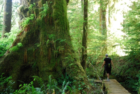
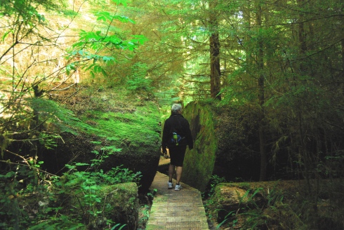
The accessible area makes up only about 1/100 of the park and there are walkways so you can get over numerous springs and bogs to get to the largest trees without having to walk over their roots which are susceptible to damage.
I was very disappointed with the state of both the road and the park itself. The logging road has been allowed to deteriorate to such a degree that I’d say anything bigger than our van, Rosie, will not be able to make it down the road in the very near future as the trees have grown over the road and are closing in from both sides. The park itself looks like not a cent has been spent on the place for the last 30 years, the walkways were broken or shoved to the side, areas where water has damaged the paths haven’t been fixed, and the whole place has a aura of neglect and decay. It almost feels as if the government is hoping either the public will forget about the place, so that they can turn it back over to the logging companies, or they are trying to create one of those parks that exist to protect a rare ecosystem while being inaccessible to the public.
(There’s nothing wrong with that, if that’s the plan, but our Provincial government which has been in power since 2001, and is very definitely pro logging. They have produced many “papers” over the last few years that suggest logging in our Provincial parks is necessary for the health of the logging companies. No so much interested in the health of the parks though!)
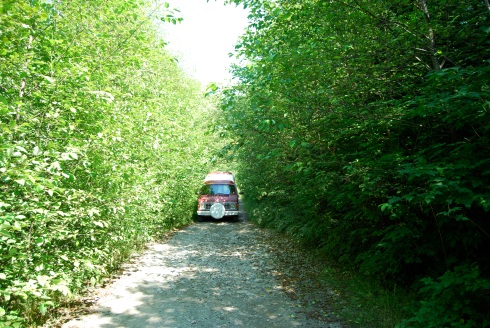
The condition of the road into the park. In another couple of years the road will be so overgrown, nothing will be able to get down it!
Either of these things would be a slap in the fact to all those who fought to save this beautiful area from destruction and bring it to the attention of the general public and make it accessible all those years ago!
We visited the park, then found a very pretty hunters campsite to spend our second night, just down the road from the park. The next morning we headed out intending to spend one more night somewhere around Lake Cowichan before we had to back for Richard’s surgery, but we made the fatal mistake of turning on the cell phones! Lo and behold there was a message from daughter #1 telling us Richard had a prescription waiting for him in Sidney that he needed to start taking it 24 hours before his dentists appointment, so we reluctantly headed back down the island.
On the Friday, Richard had his surgery and the next morning we headed back to Penticton. We’ll stay here now till the beginning of September, picking up the last little bits of things we need for Baja, then after the Labour Day weekend, we’ll head back to the island. We’ll stay for a while visiting and picking up the things we know we can only get in Victoria, then say our reluctant goodbyes to our kids and grandkids, then on to the Port Angeles Ferry, down the Olympic Peninsula, and off to Baja.
Next time we talk, we’ll be back on our beach and I’ll tell you all about our adventures getting there.
TTFN

